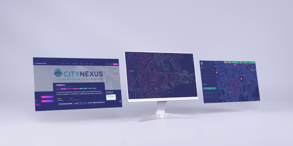
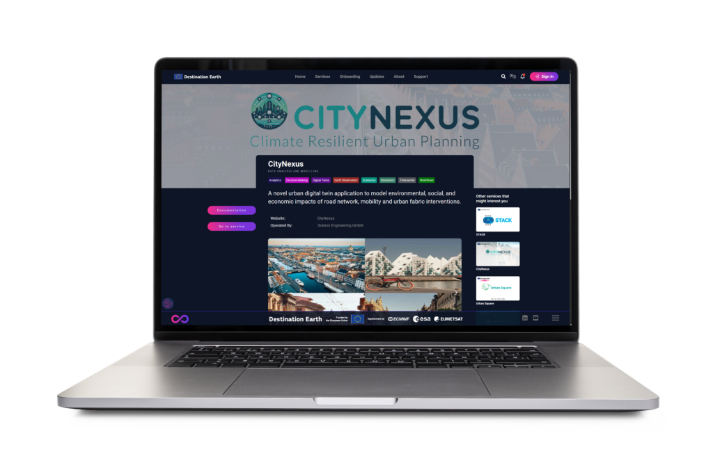
CityNexus is an AI-powered platform that integrates mobility, environmental and socio-economic data to support data-driven urban planning.
It simulates “what-if” scenarios using Earth Observation and mobility data to test sustainable mobility policies and urban transformations.
A Digital Platform for Urban Intelligence
At its core, CityNexus is an AI-powered platform that combines mobility, environmental and socio-economic information to analyze and forecast the impact of policy and infrastructure changes.
Overview
In the face of growing urban complexity, CITYNEXUS emerges as a powerful platform designed to help cities plan, test and implement sustainable policies for mobility, air quality and climate resilience.
Built on advanced AI, Earth Observation and mobility data, CITYNEXUS offers users an intelligent environment to test urban interventions before being implemented, quantifying impacts on traffic patterns and air quality to support data-driven policy making and urban planning.
The Urban Challenge
Cities today face an intricate web of interdependent issues:
Traffic congestion and mobility inefficiencies
Air pollution and climate targets
Rising infrastructure costs
Fragmented information prevents a holistic urban view
CityNexus bridges these gaps through integrated data, advanced analytics and scenario-based simulations that reveal the real-world effects of planning decisions before they happen.
.
Key functionalities and innovation
CITYNEXUS stands out for its interactive and explainable approach to simulation and decision support. Among its key features:
What-if Scenarios: Simulate policy options such as low-emission zones, road redesign, or customized means of transport.
Air Quality Modelling: Estimate pollutant concentrations per street segment, including NO₂, CO and PMx.
Flood-Mobility Integration: Evaluate how flood events affect accessibility and traffic flow.
Explainable AI (XAI): Understand the causes of environmental impacts and receive data-driven mitigation suggestions.
Interactive Platform: Configure, visualize and compare scenarios via the web interface in DestinE.
This modular design ensures flexibility, scalability and relevance for cities of any size.
Demonstration cities
Diverse urban contexts to test scalable solutions.
Commitment to achieve climate neutrality.
Urban policies driven by innovation and digitalization.
Copenhagen, Denmark
Bologna, Italy
Aarhus, Denmark
Seville, Spain
Data sources
CityNexus relies on a multi-layered modelling framework supported by diverse data inputs:
Scenario Simulation: “What-If” Urban Planning
CITYNEXUS allows users to configure and run customized simulations, exploring the impact of various interventions, including:
Road speed adjustments: modify speed limits for selected street segments.
Low Emission Zones (LEZs): restrict motorized circulation in specific areas.
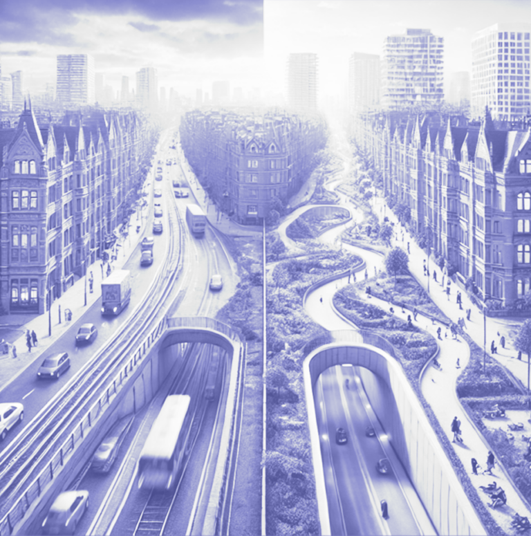
Road redesign and land use change: evaluate changes in land use and air quality by tunneling or setting streets underground.
Active mobility promotion: increase the share of electric vehicles or cycling.
As a component of the European Commission’s Destination Earth programme, CITYNEXUS contributes to the Digital Twin for Climate Adaptation and Urban Planning. Its integration with other DestinE modules, such as IAM, Vault and Dashboard, ensures interoperability, scalability and long-term operation within Europe’s evolving digital-twin ecosystem. This alignment enhances Europe’s ability to simulate urban-environmental systems, inform climate-adaptation policies and connect science with decision-making.

