Mapping the impact of armed conflict through Earth Observation
Enhancing humanitarian action and recovery atrategies through empirical data analysis and population modeling in Tel Afar
Overview
Gathering accurate data in urban areas affected by armed conflicts is crucial for effective response strategies. The complexity of urban settlements coupled with post-war deprivation necessitates objective and empirical data. Remote satellite imagery analysis provides a valuable tool to detect key urban features, inform interventions, and facilitate the provision of essential services in challenging contexts where resources are limited and local communities are difficult to reach.
Combining high-resolution satellite imagery analysis, field survey and population modeling, MindEarth helps humanitarian organisations trace the effects of armed conflict on urban communities and built environment.
Conflict recovery efforts and the role of data
In the aftermath of prolonged armed conflicts, the restoration of essential services such as shelter, water, and sanitation infrastructure poses significant challenges. These can persist for decades, also due to the scarcity of available resources. Obtaining objective and empirical data on the state of the built environment, condition of infrastructure and the distribution of population of impacted areas, is vital for guiding effective humanitarian action and recovery strategies as it allows them to plan and implement appropriate interventions tailored to the specific requirements of the community.
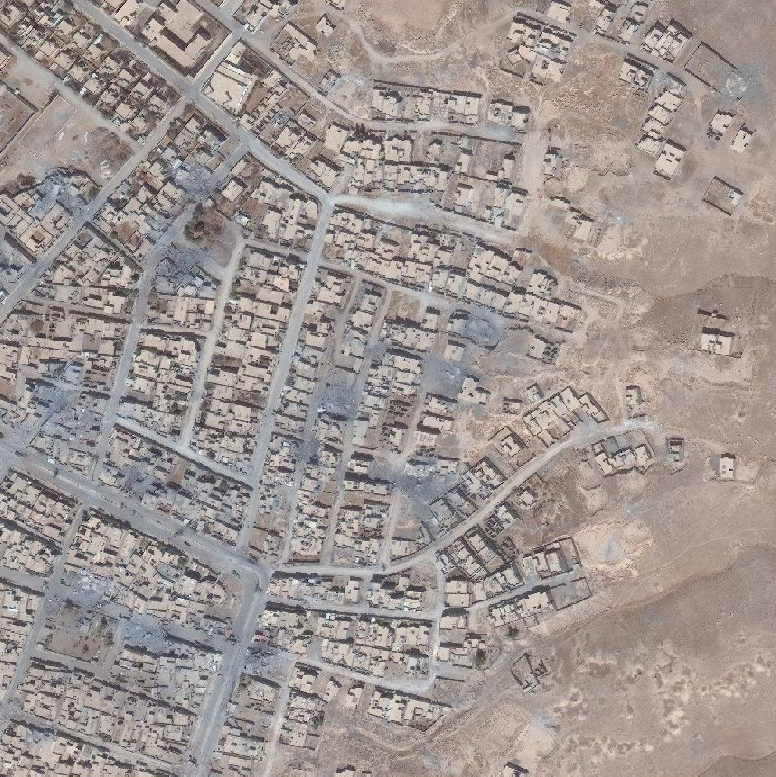
Tracing the impact of conflict in Tel Afar City
Tel Afar in Iraq suffered severely during the 2014-2017 Iraq Civil War under the control of the Islamic State Group (ISg). The conflict caused human casualties, population displacement, and the disruption of vital services like water, food production, healthcare, and electricity. Despite the passage of time, Tel Afar still confronts challenges in its recovery.
The Water & Habitat Department of the International Committee of the Red Cross (ICRC) acknowledges the importance of reliable ground data for restoring these essential services in Tel Afar.
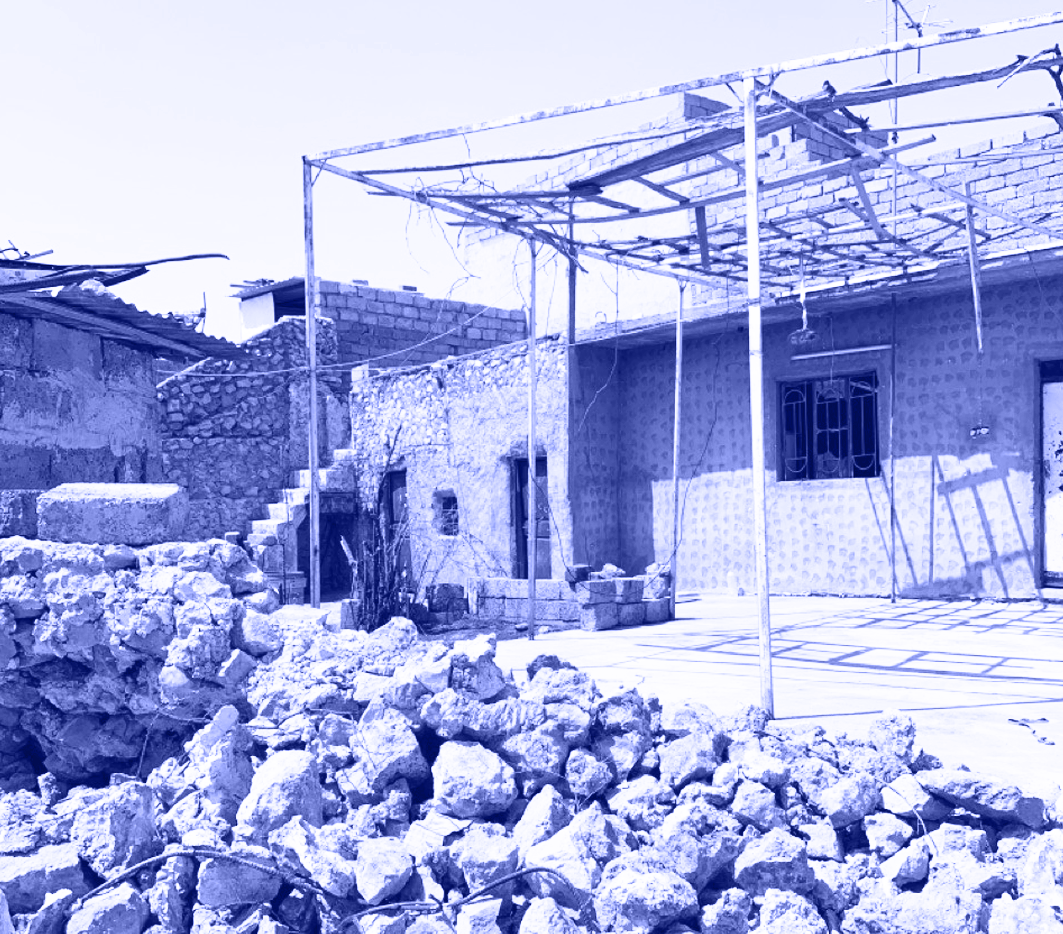
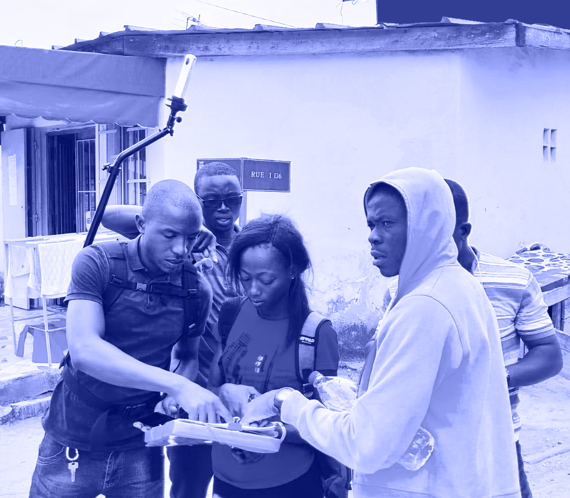
To support these endeavors, MindEarth generated a comprehensive dataset on population distribution, building footprints, land-use, and destroyed buildings by employing a multi-step approach. This involved utilizing Very High-Resolution (VHR) satellite imagery to detect building footprints and produce vector maps from 2010 to 2019. This process allowed for the identification of buildings destroyed during the conflict as well as the tracking of new constructions. In addition, on-site photographic surveys were conducted by ICRC operatives to collect data on building heights, refining the information regarding building land-use and destroyed structures.
Built environment conditions assessment
During the conflict in Tel Afar, we utilized satellite imagery analysis and field surveys to map the destruction of buildings and track the subsequent growth throughout the area. By comparing pre-conflict footprints with post-conflict imagery, we identified and quantified the extent of damage. Additionally, we monitored changes in building footprints over time to observe patterns of reconstruction and growth
Very high Resolution satellite imagery over Tel Afar
Building change and demolitions during conflict
Building land use detection
Using Very High-Resolution (VHR) satellite imagery, manual labeling, and artificial intelligence (AI), we determined building land use. The satellite imagery allowed us to initially classify buildings into categories such as residential, commercial, industrial, and public facilities. To validate our findings, fieldwork surveys were conducted by ICRC operatives and ground survey teams. Existing area analysis reports were further used to validate our predictions.
Building-level land use detection, 2019
Building-level land use detection, 2019
Commercial
Industrial
Public
Residential
Education
Leisure
Population Modeling and Analysis
opulation models were developed for different time periods, including before, during, and after the conflict, using the 2010 baseline population distribution derived from the 2009 Tel-Afar Census. The models were extended to the pre- and post-conflict time-steps (2014, 2017, 2019), accounting for the impact of conflict on occupancy rates and typical residential densities in the local area. Resulting population estimates were then mapped at the individual building level and aggregated at the census area level for each time-step.
Building-level population estimates
Census-level population estimates
Fostering post-conflict recovery using data
Two years after the conclusion of the Iraq Civil War, signs of recovery are emerging in Tel Afar. Population levels are rising, and slow but steady urban growth is noticeable, particularly in peripheral areas.
The possibility to rely on accurate ground data will play a pivotal role in shaping Tel Afar’s recovery process. By leveraging this data, public sector institutions and humanitarian organizations can make informed decisions, allocate resources effectively, and implement tailored strategies to address the city’s specific needs. Such efforts are crucial in restoring essential services and rebuilding the foundations of a thriving community.