Urban Digital Twins: shaping the future of smart sustanable cities
A pilot urban digital twin model of the Castelli Romani region to showcase the
system capabilities for urban planning and decision-making.
Overview
In a world driven by technological innovation, cities are constantly seeking new approaches to improve urban planning and development. Among these, the concept of urban digital twins has emerged as a promising solution. By seamlessly integrating realistic 3d models, real-time data, advanced simulations and AI, digital twins offer a transformative tool that can revolutionize the way we shape the cities.
Our urban digital twin models are developed by integrating diverse and valuable data types - from ultra-high-resolution UAV imagery and satellite-derived Earth Observation (EO) products, to transportation data and authoritative geospatial layers - in a coherent and explorable virtual environment.
Empowering Data-Driven Urban Planning and Decision-Making
Urban Digital Twins are advanced digital representations of urban environments, presented in 3D or 4D, that integrate diverse thematic geo-located information layers and enable the generation of real-time “what-if” scenarios and simulations.
By combining ultra-high-resolution UAV imagery, Earth Observation (EO) products, real-time sensor data, and authoritative geo-spatial data, these innovative systems create a cohesive and interactive environment.
This immersive and interactive platform empowers, often enriched with virtual or augmented reality functionalities, allows policymakers and urban planners to visualize, navigate, and explore urban landscapes, fostering informed decision-making and enabling comprehensive understanding of complex urban systems.
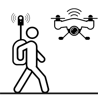
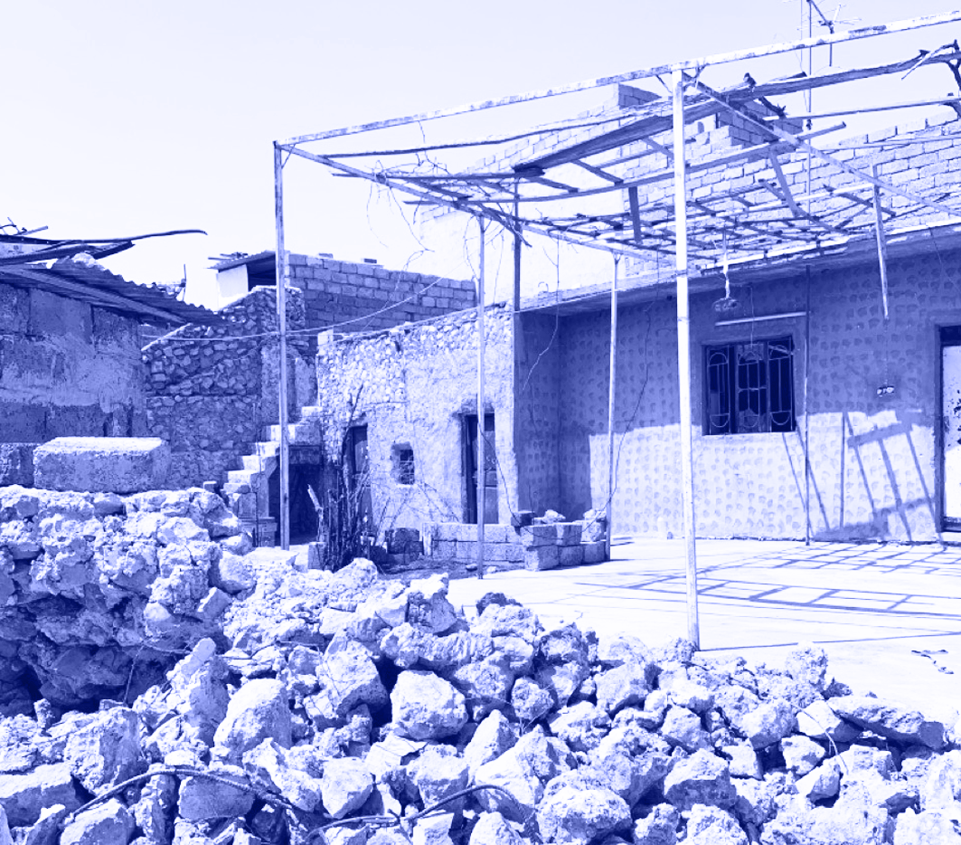
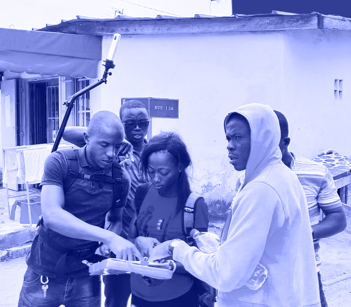
Data collected on site
Generation of a fully textured, explorable, geo-referenced 3D model have derived from in-situ UAV and street-view panoramic imagery.
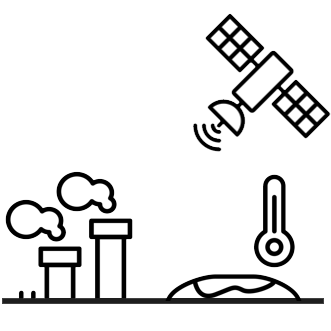
Earth Observation data
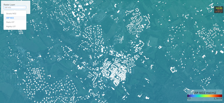
Environmental indices from sentinel-based products (i.e., monthly median S3 day/night LST, S5P tropospheric NO2 concentration, S1-based subsidence deformation rates)
Open & commercial data
Built environment indicators, weather and air quality measurements, mobility and transportation indicators hydrogeologic hazard maps and more…
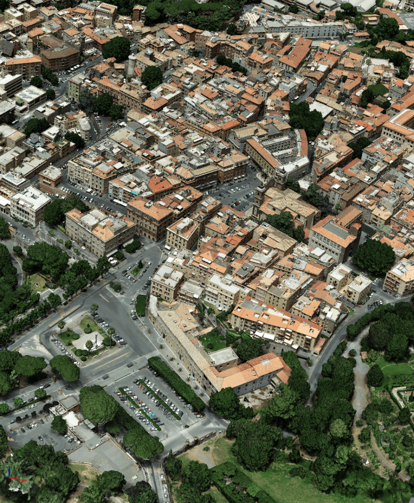
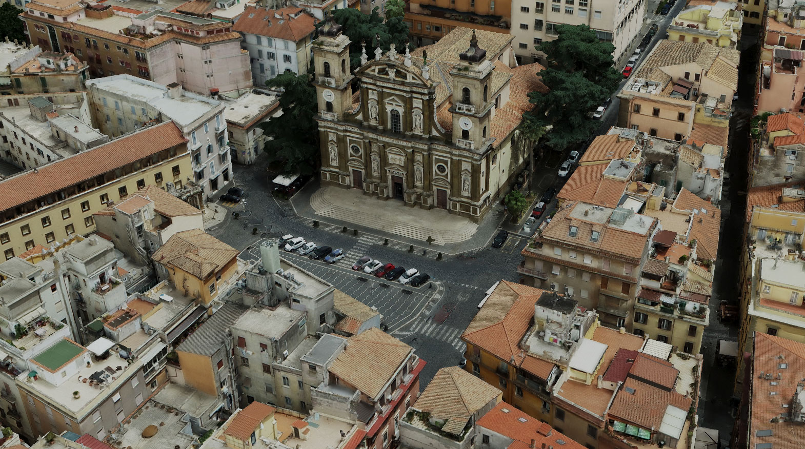
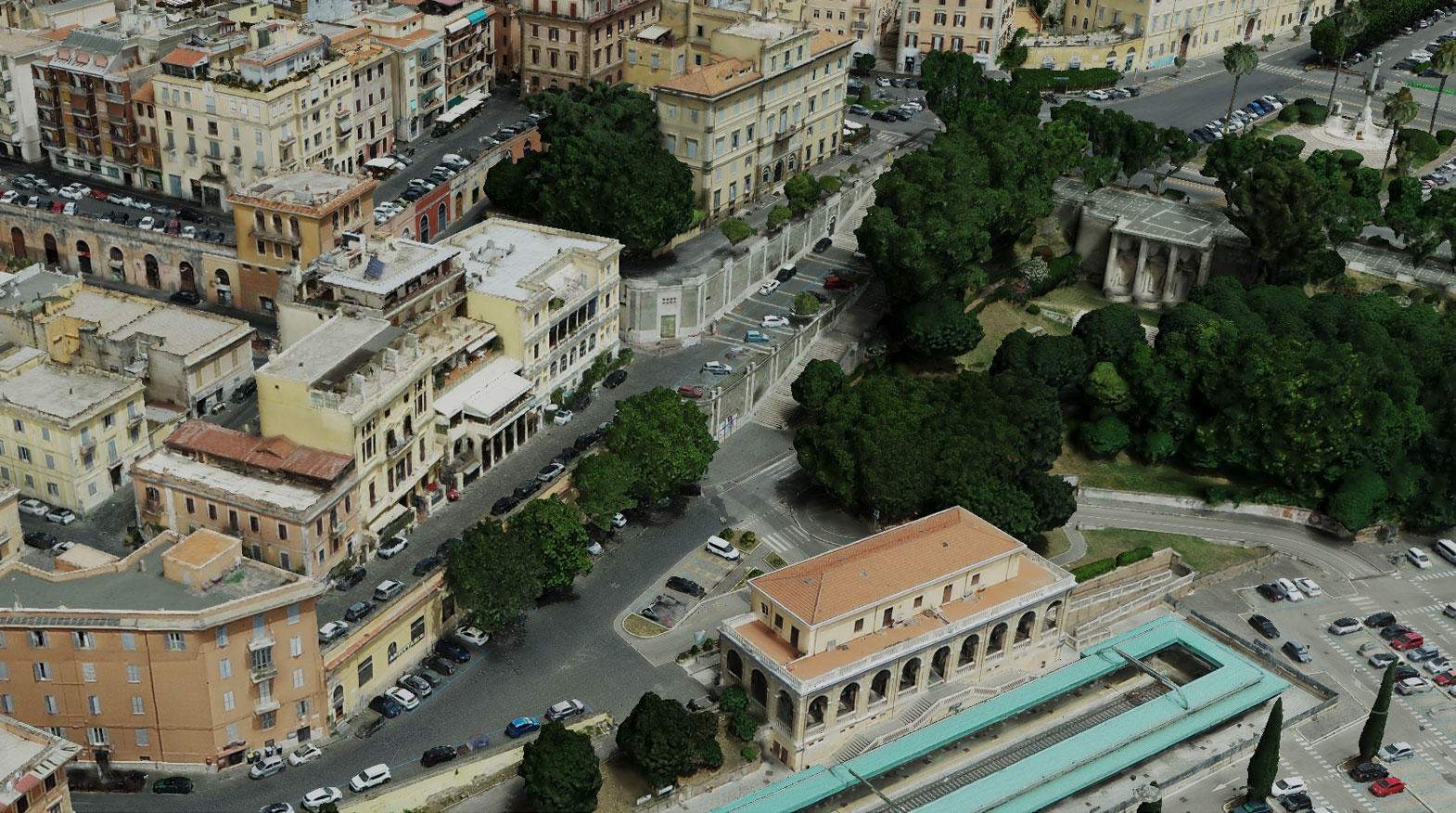
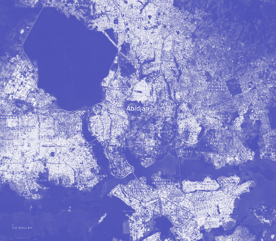
An Urban Twin Digital in the heart of Lazio's Castelli Romani
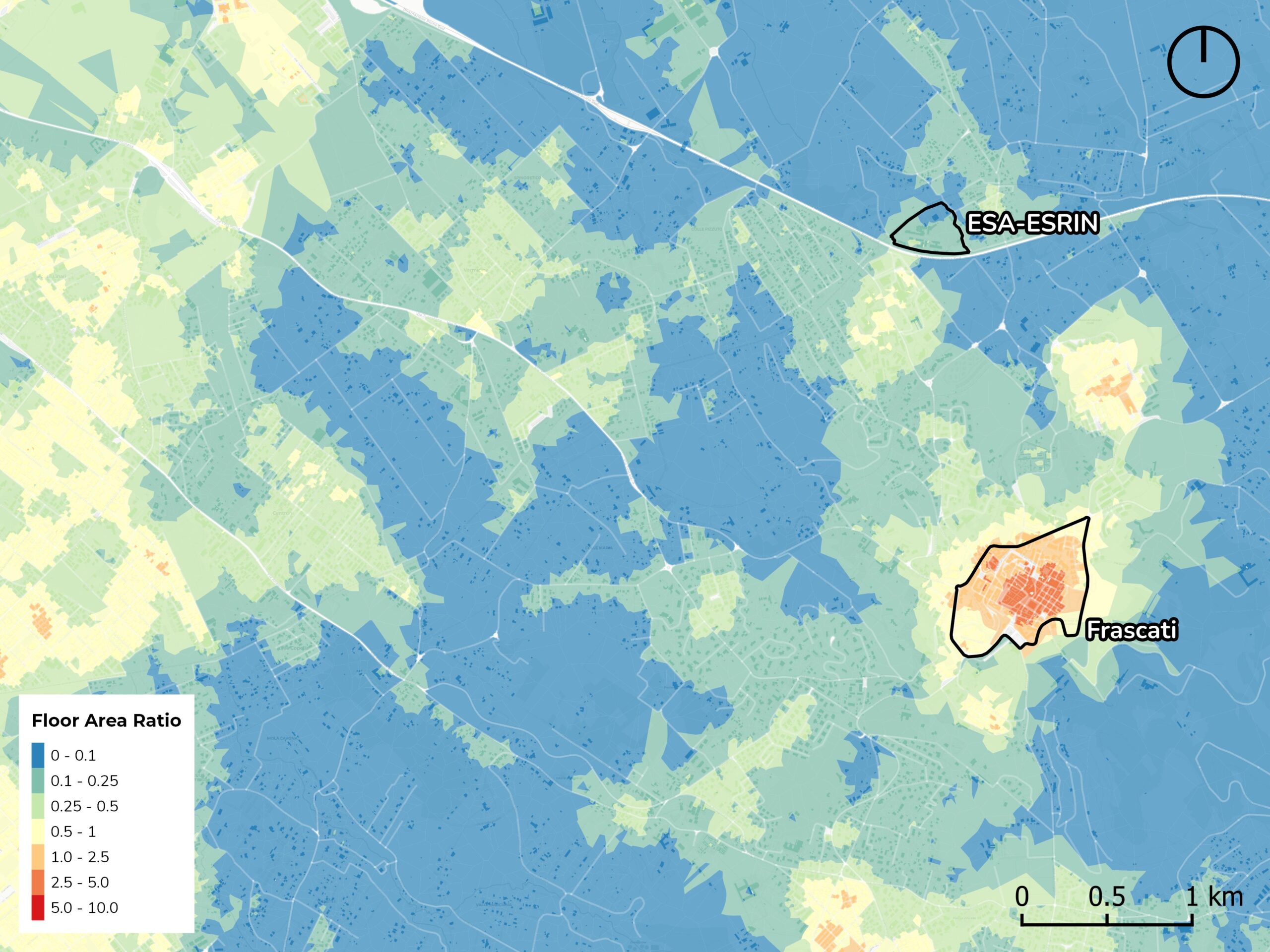
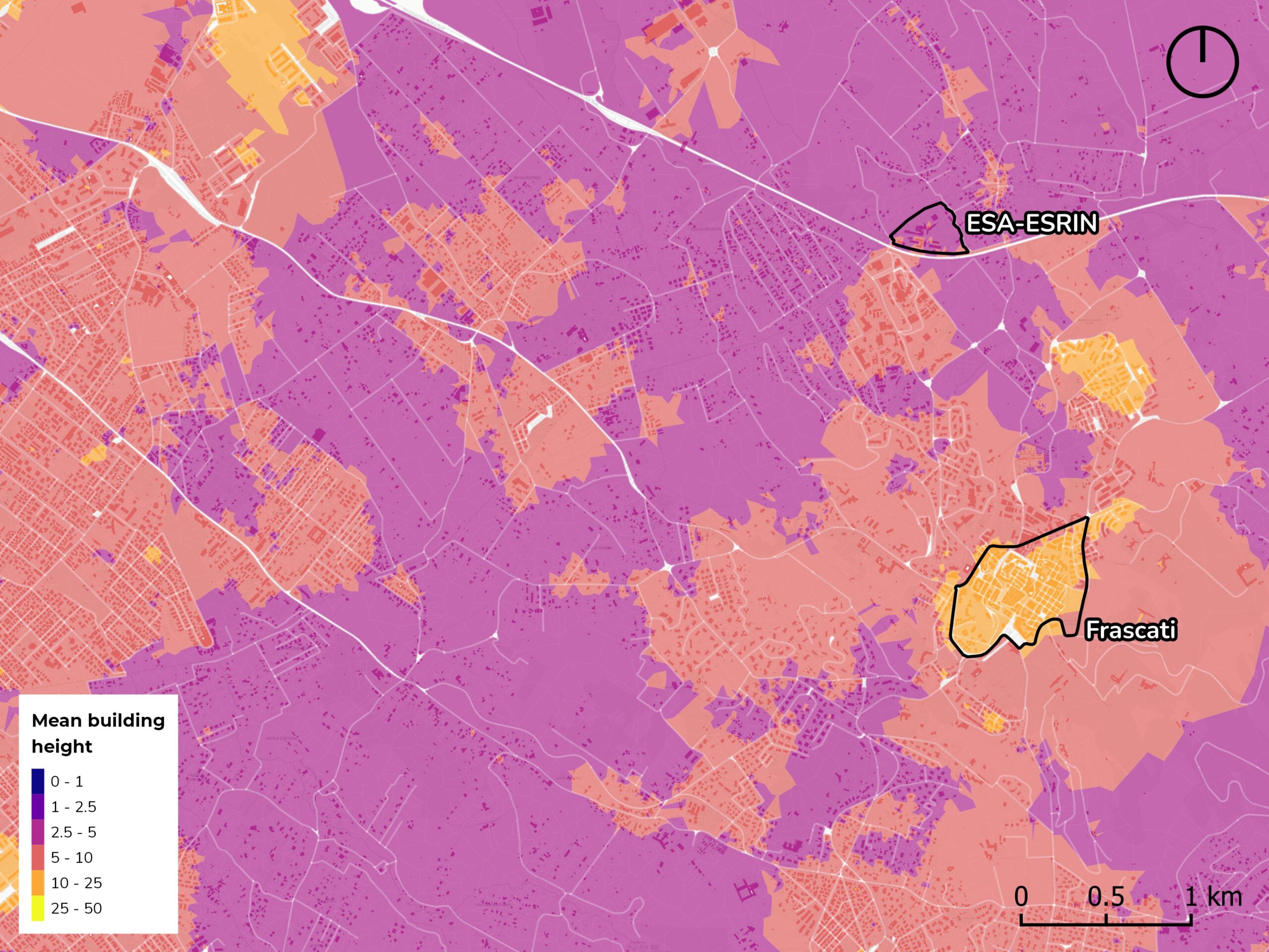
MindEarth, in collaboration with DLR and ESA Φ-Lab, has developed an advanced system for the visualization and exploration of a pilot 4D Urban Digital Twin (UDT) covering an extensive area of 83,000ha in the Roman Castles region of Italy.
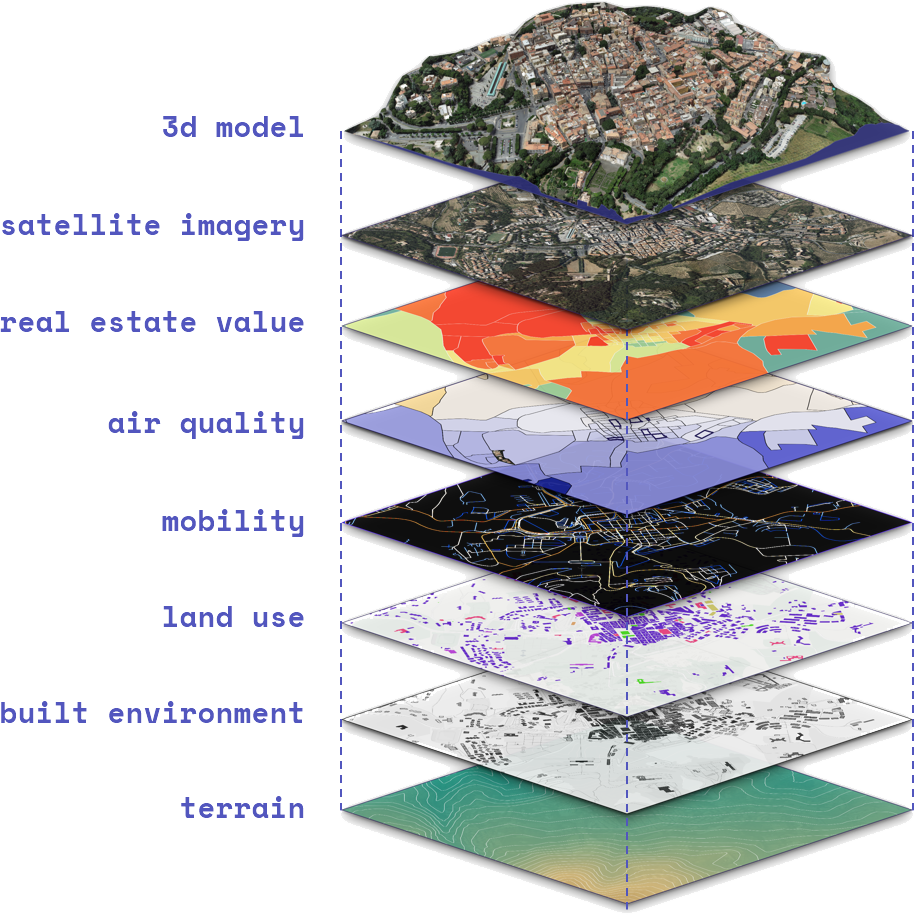
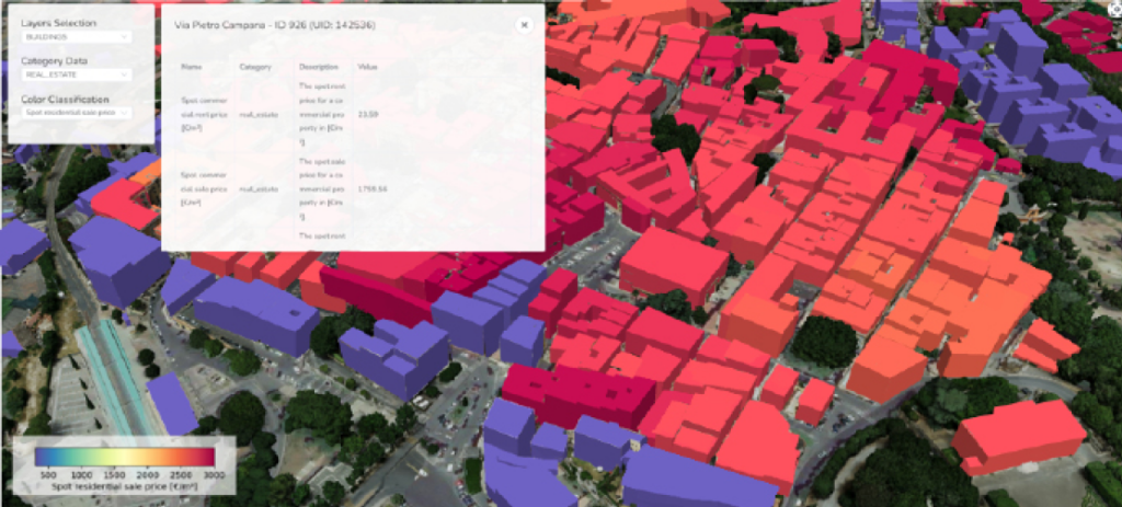
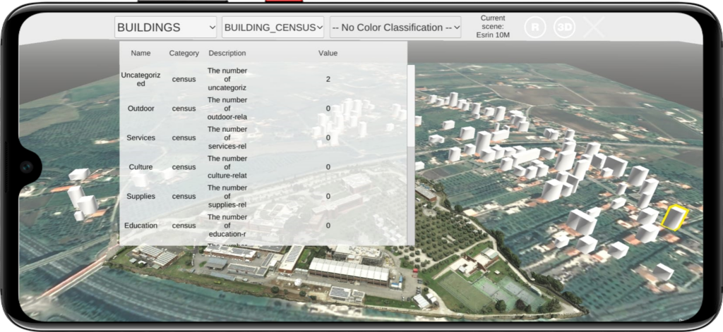
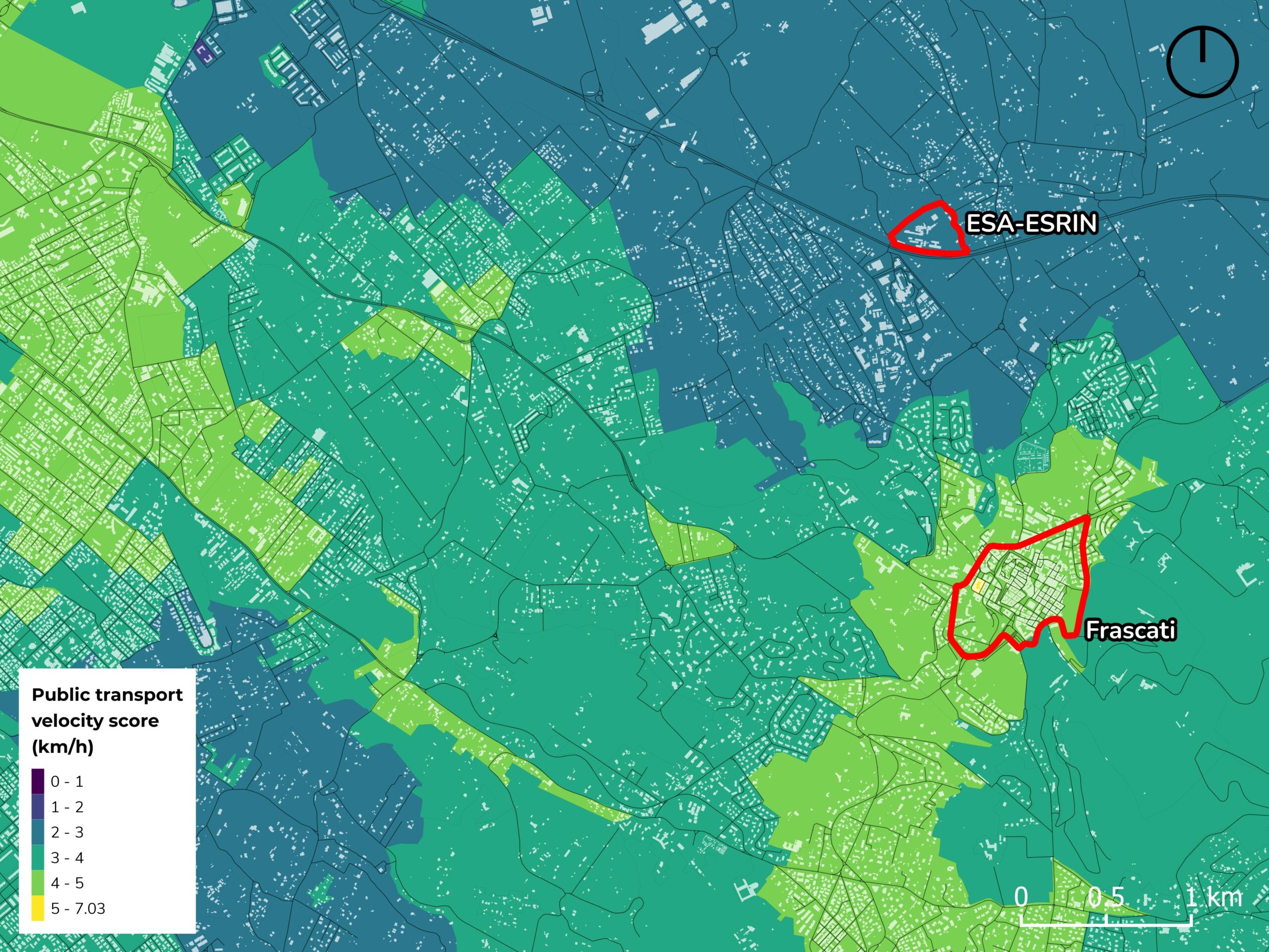
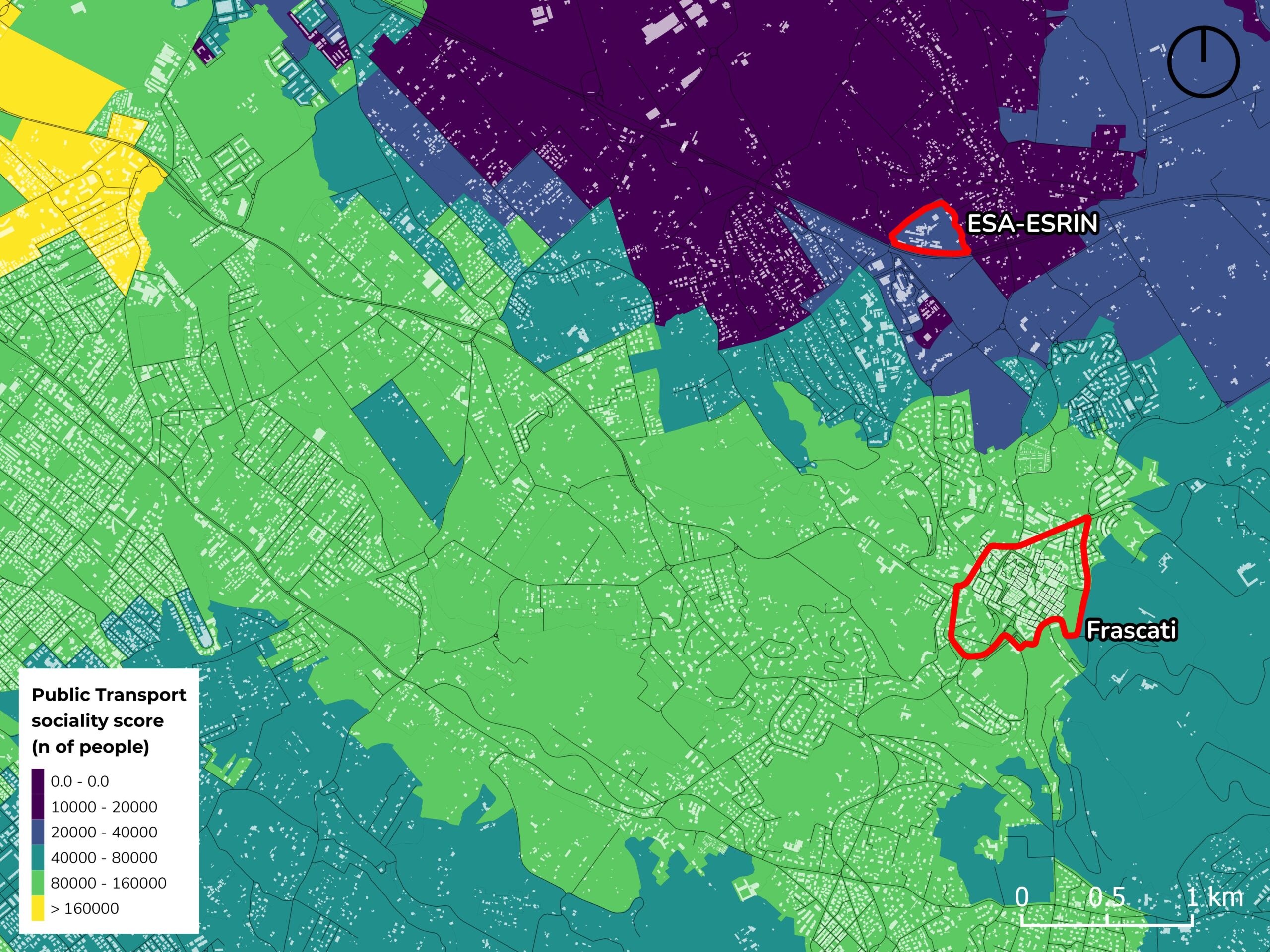
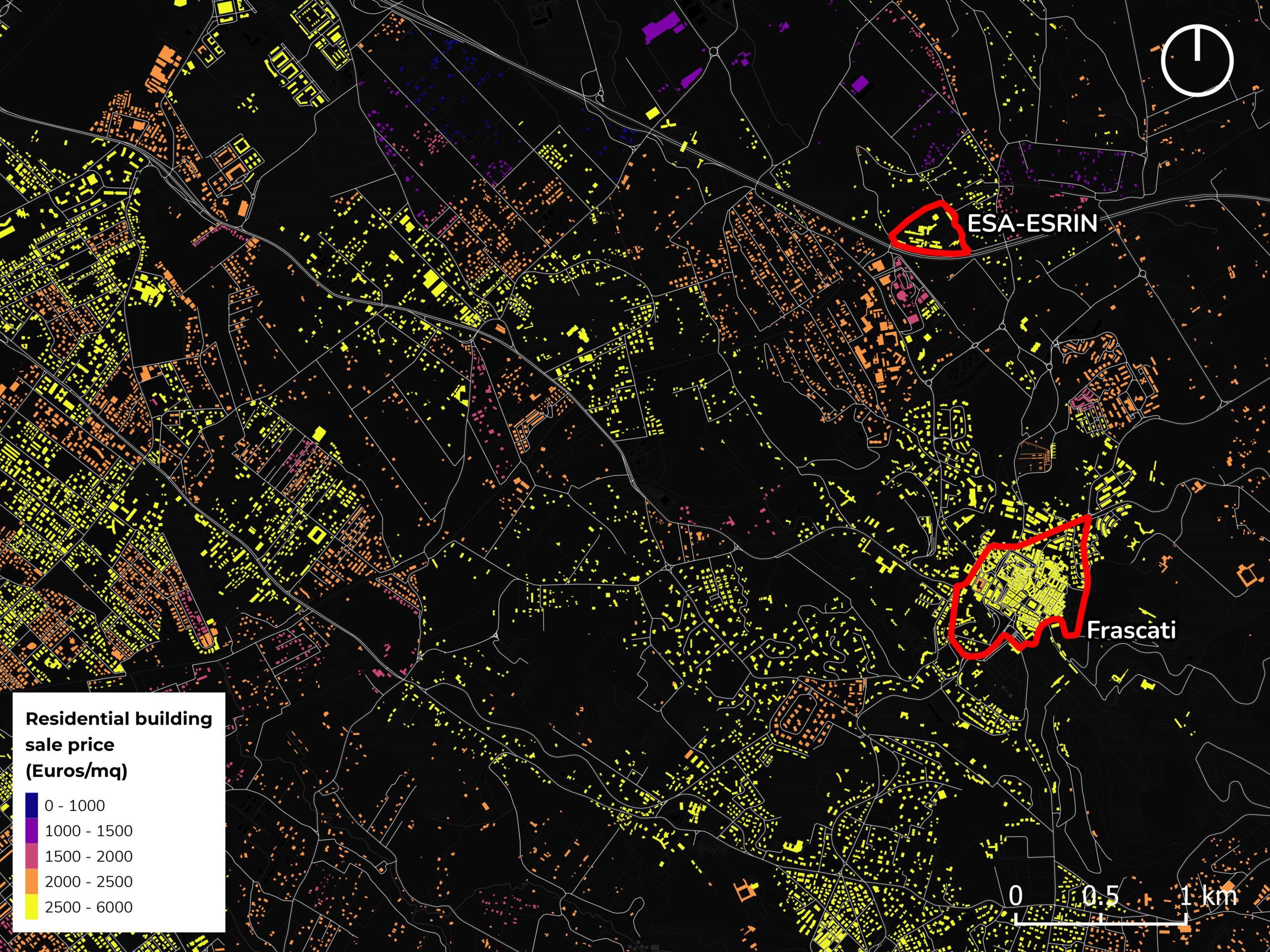
The model incorporates a wide range of information layers, including Sentinel-based products, census data, built environment, environmental indicators, terrain topography, hazard maps, transportation indicators, mobility data and real estate information.
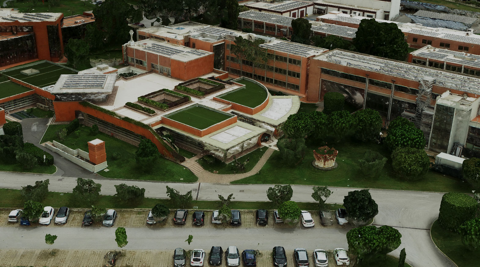
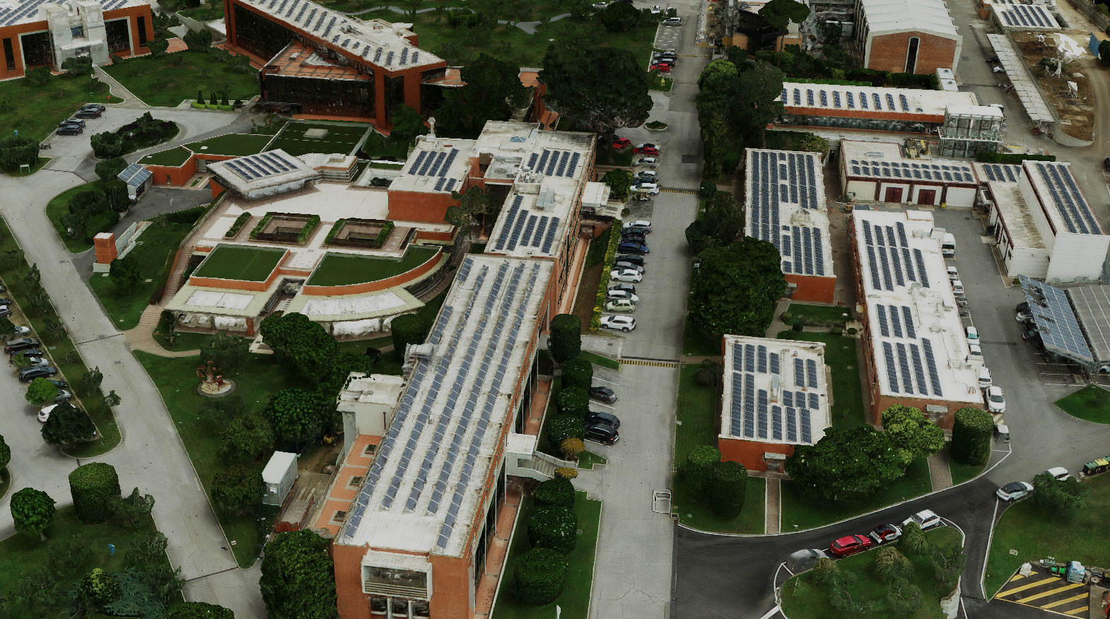
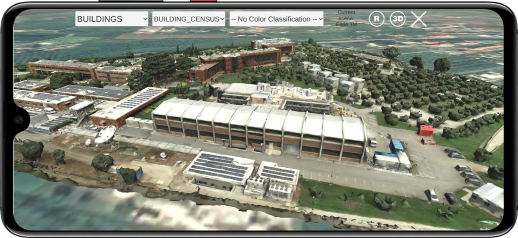
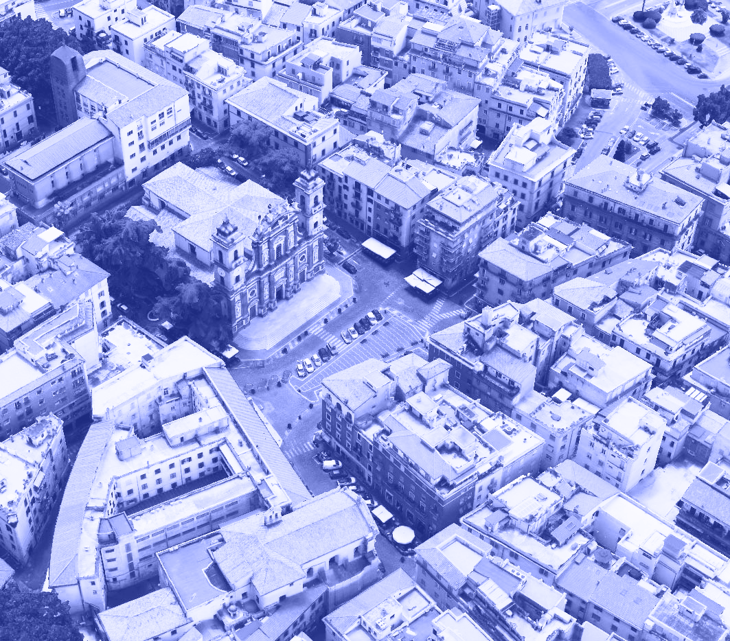
Additionally, specific sub-areas, such as the ESA-ESRIN establishment and the Frascati town center, have been meticulously modeled in fully textured 3D, derived from on-site UAV and street-view panoramic imagery.
High-fidelity 3D model
With the use of ultra-high-resolution multi-spectral drone and UAV imagery (with a nominal resolution 3 cm or lower), our fully-textured 3d models can truly capture the complex details of any area.
Decision-makers can interactively navigaate the model to better understand the spatial context and make informed decisions.
Geoinformation layers
To build a complete and informative model of any area of interest, we rely on a variety of spatio-temporal data layers, including freely-available EO products, open data on buildings, streets and points of interest, terrain models, mobility and transport data, environmental hazard data.
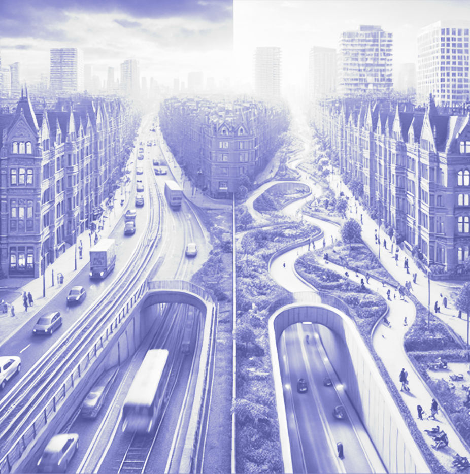
Whether it’s preparing for natural disasters, addressing climate change challenges, or responding to unexpected events, digital twins enable cities to be better prepared and resilient.
Through “what-if” scenario simulations, urban digital twins provide a risk-free tool to test strategies, evaluate impact, promoting sustainability and resilience.
WHAT-IF SCENARIO 01
How did COVID-19 lockdown
affect mobility and air quality?
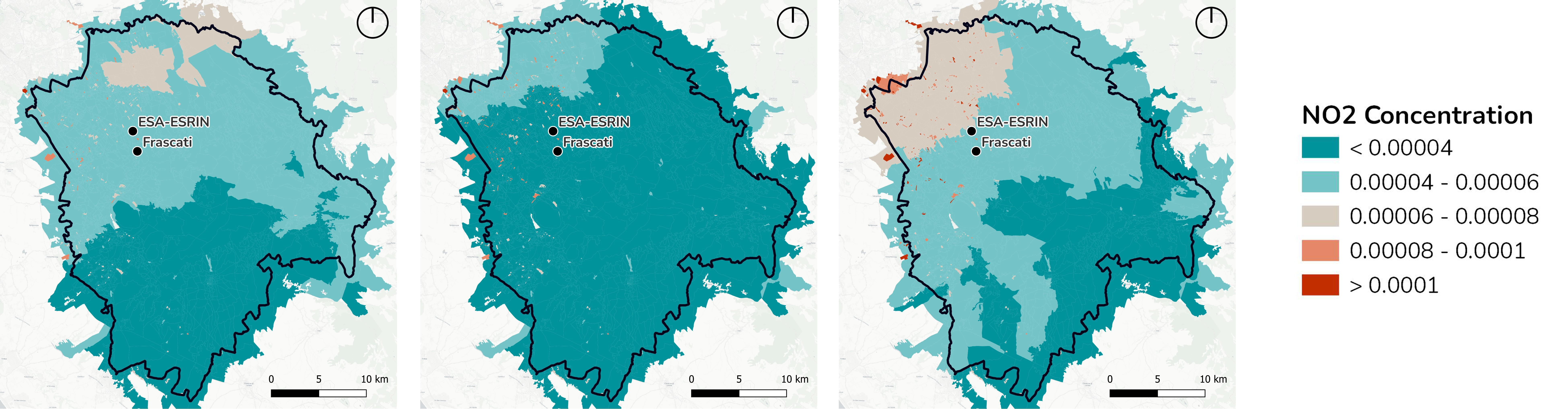
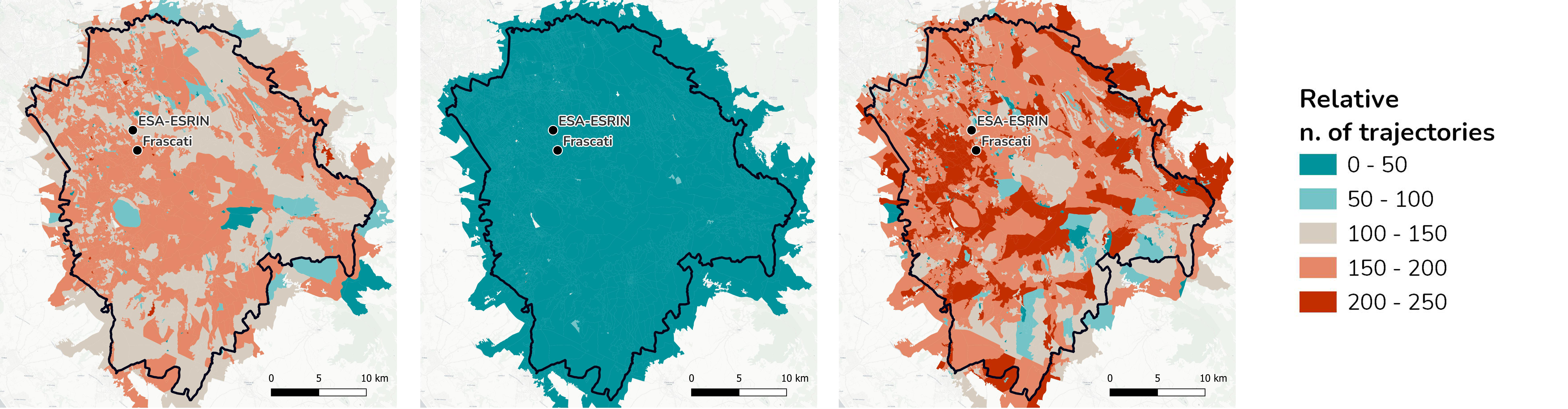
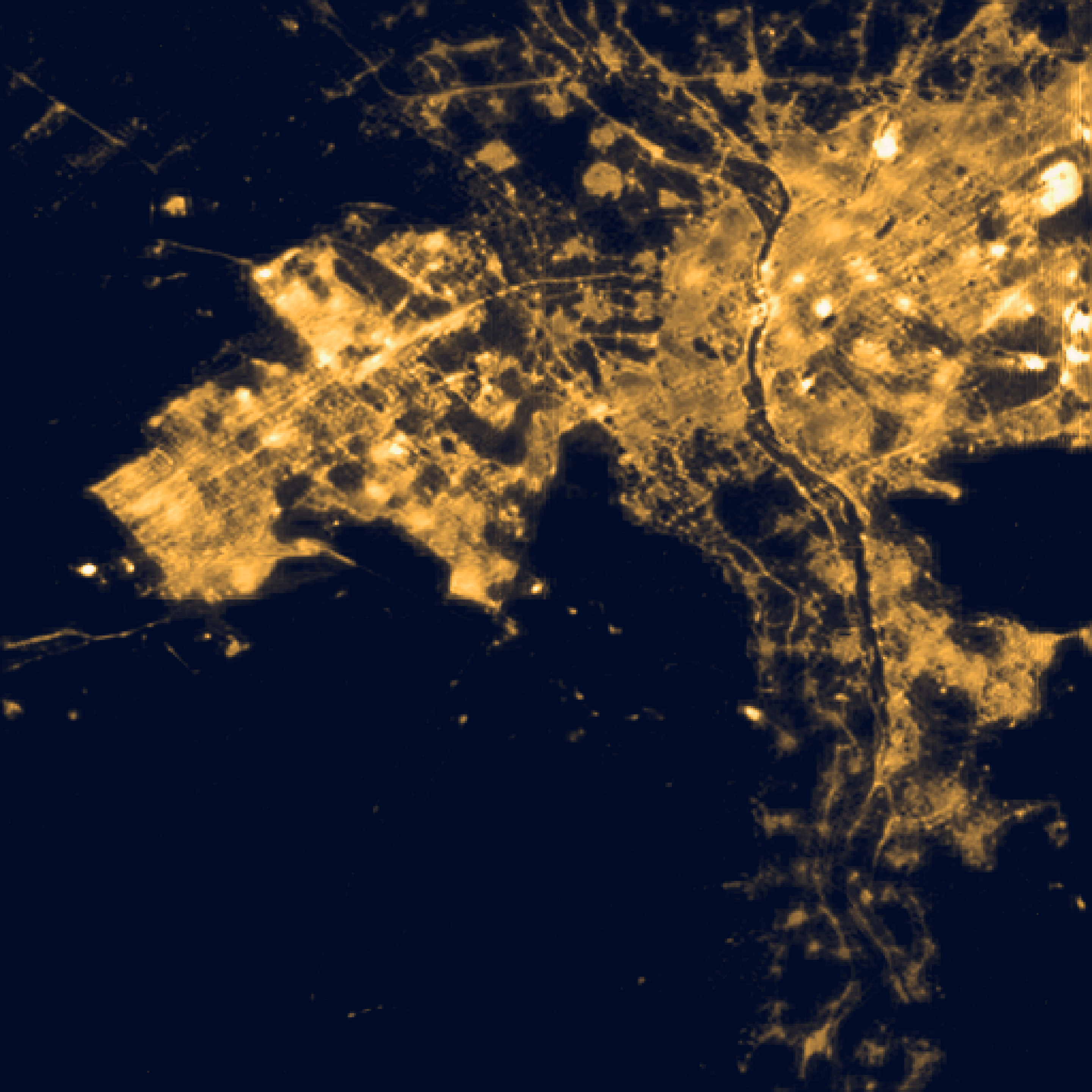
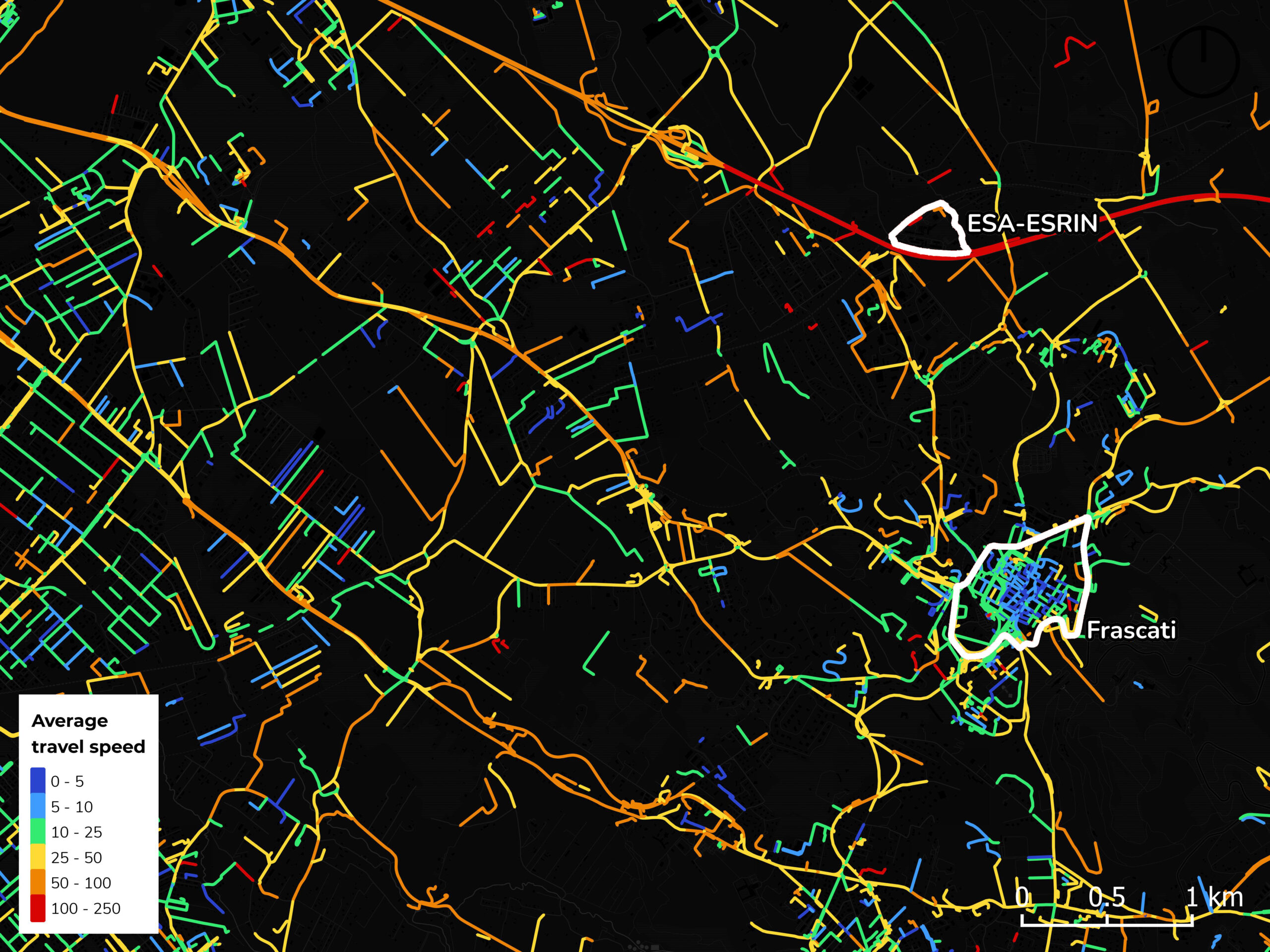
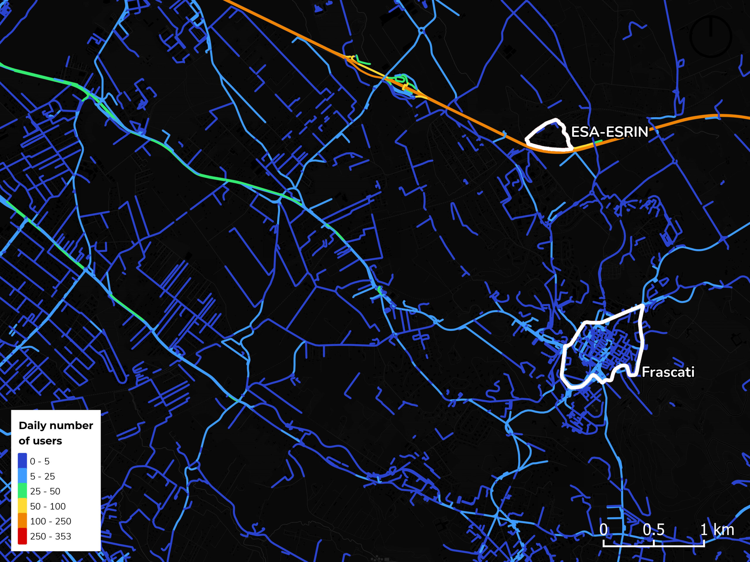
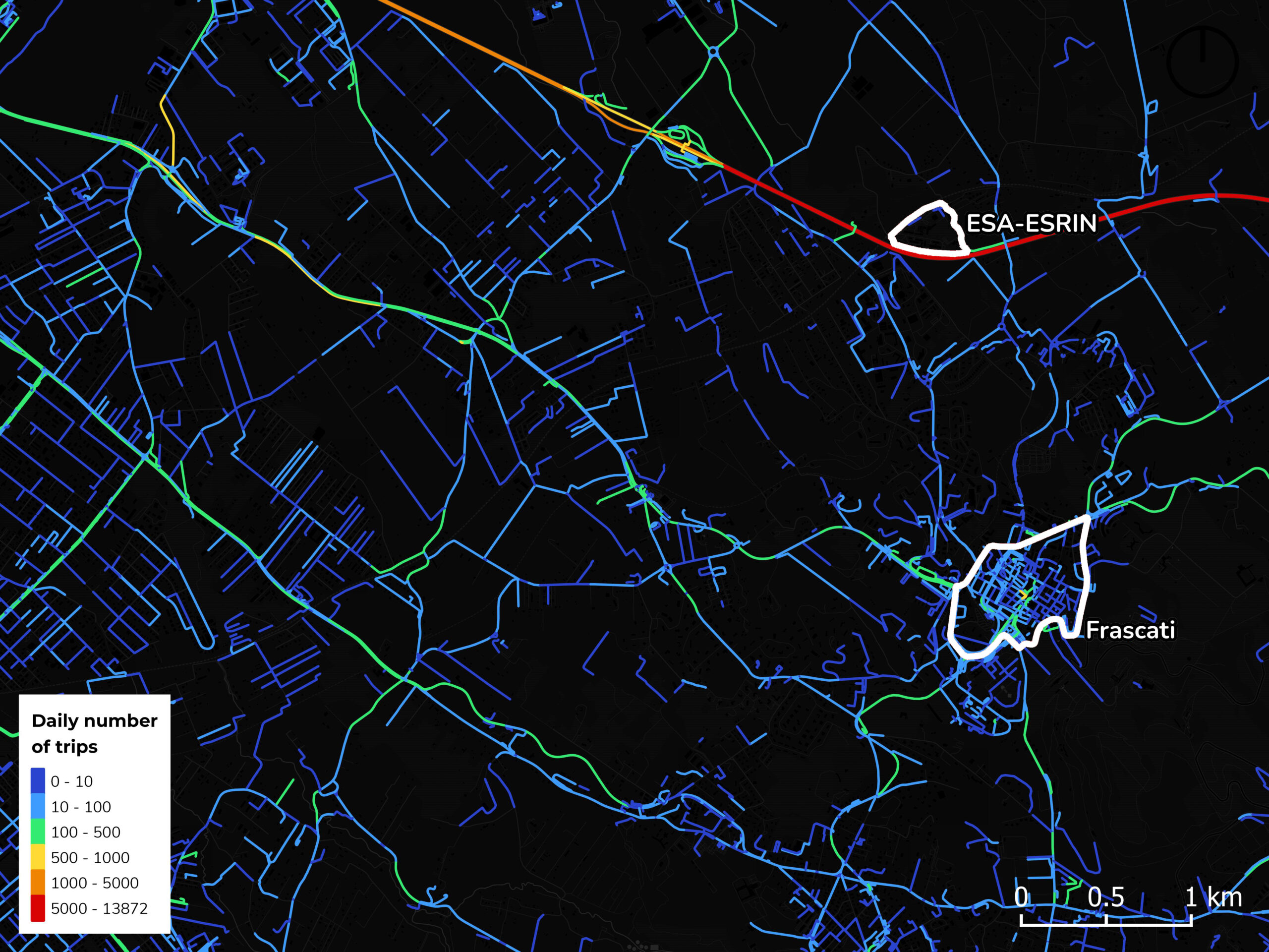
The COVID-19 pandemic brought about significant changes in mobility patterns and air quality due to strict lockdown measures. To understand the extent of this impact, our Urban Digital Twin leverages a combination of data layers, including atmospheric pollutant concentrations from satellite observations and ground-level air monitoring stations, along with GPS-derived location data from around 1 million users.
By comparing monthly average concentrations of atmospheric NO2 with variations in human mobility, a clear correlation between restricted movement and a significant (albeit temporary) drop in atmospheric NO2 concentrations is clearly observable. The system generated visualizations and maps showcasing the spatial distribution of these changes, highlighting the positive effects of the lockdown on air quality.
WHAT-IF SCENARIO 02
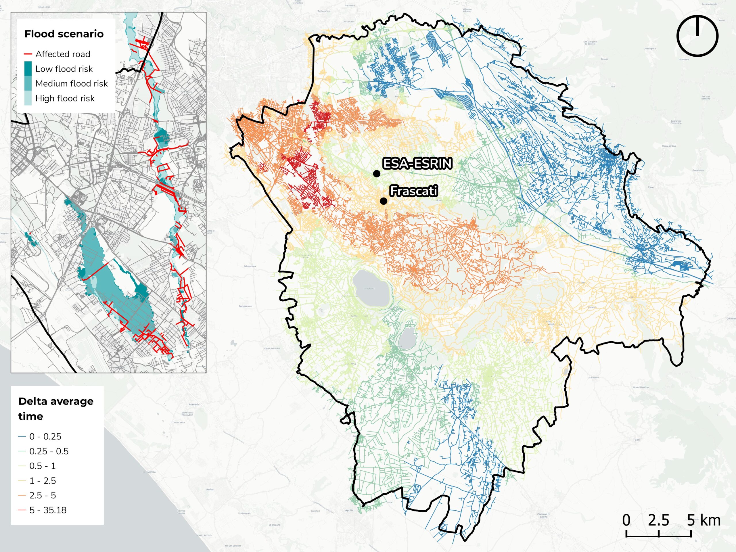
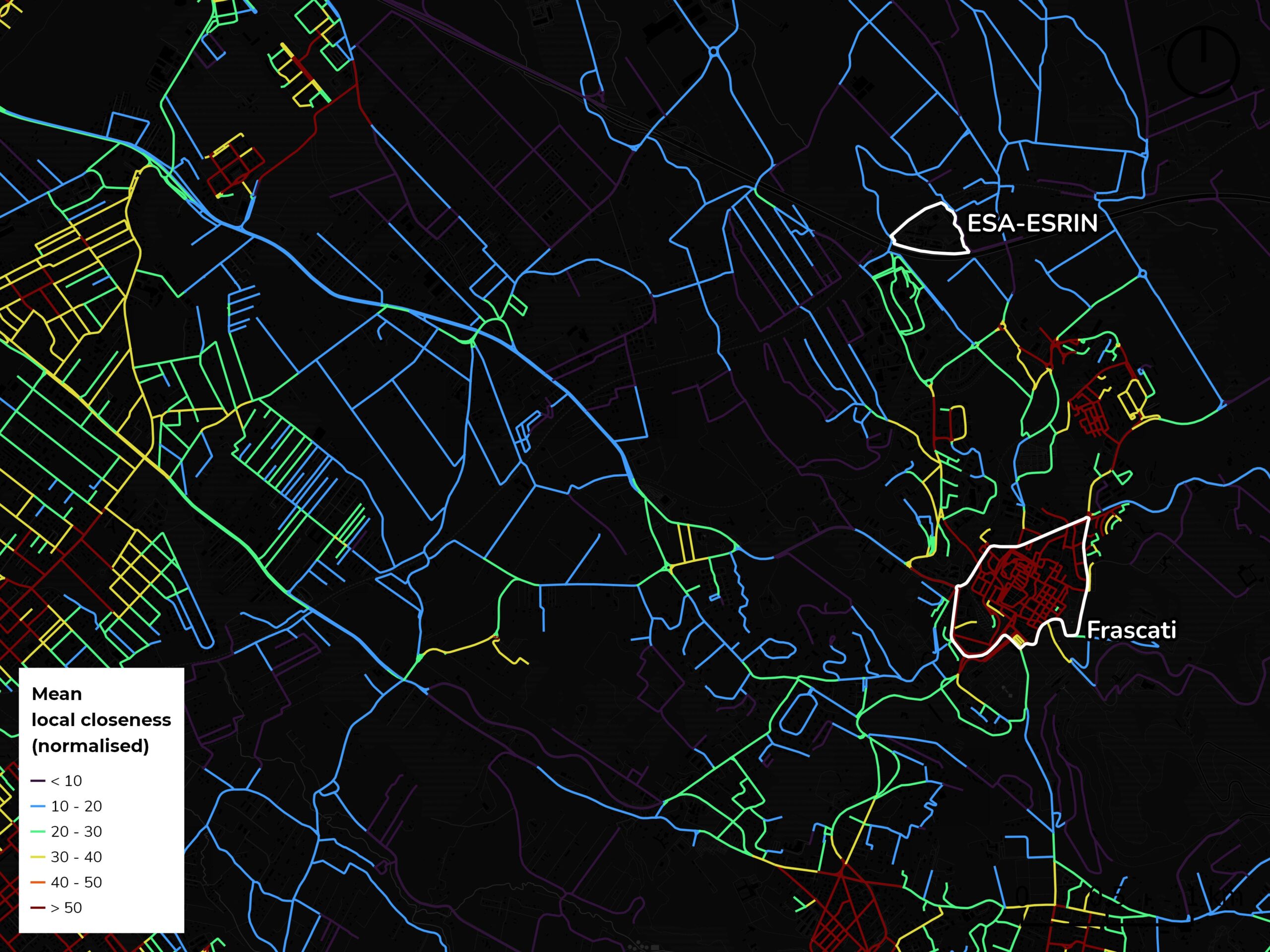
What is the impact of a flood event on the road networks?
Urban areas are vulnerable to various natural hazards, including floods. Our Urban Digital Twin utilized hydrogeological risk data and mobility records to quantify the impact of a simulated flood event on the accessibility of the road network in the targeted region. By combining these datasets, the system assessed the potential disruptions to the road network and modeled the redistribution of flows within the affected areas.
Through graph theory metrics, MindEarth's UDT evaluated the propagation of the impact of punctual failures on travel duration across the wider network. By visualizing the affected areas and simulating road network interruptions, decision-makers gained valuable insights into the resilience of the infrastructure and potential challenges faced during flood events. This information can guide urban planners in developing effective mitigation strategies and enhancing the overall resilience of the urban environment.
Accessible on any device
Our Digital Twins can be explored via different applications for a seamless user experience and accessible navigation. In this way, urban digital twins have the potential to empower citizens and foster collaboration between communities and decision-makers.
Web-GIS platform
A web-based visualization platform where users can explore the textured 3D model, dive into various data layers and extract information.
Virtual Reality
A virtual reality app where users can enjoy the same functionalities as the web platform while immersing yourself in a virtual environment.
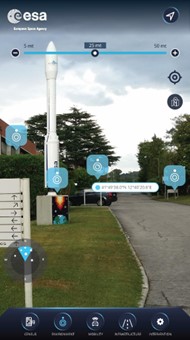
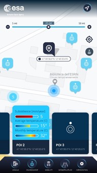
Augmented Reality
An augmented reality app where users can discover data, navigate maps, and explore points of interest using augmented reality technology.
Paving the way for the sustainable city of the future
Urban digital twins offer a comprehensive and holistic view of city landscapes, enabling planners to make more informed decisions.
This capability allows decision-makers to interrogate individual elements and components, extracting valuable information on diverse themes such as land use, real estate value, accessibility, and more. This integrated approach allows for better calibration of actions, a comprehensive understanding of the territory and its context, and the development of well-informed plans and programs.
Urban Digital Twins provide decision-makers with a powerful tool to enhance their understanding of urban environments and drive data-driven decision-making.